
Airborne laser mapping has changed the scale of Maya archaeology. In Mexico, Belize and Guatemala, LiDAR helps researchers trace buildings, causeways and agricultural landscapes that are difficult to recognize beneath vegetation. Its power is in mapping surface relief—not seeing underground or replacing excavation.
How a forest becomes a terrain model
LiDAR—light detection and ranging—measures distances using laser pulses. During airborne surveys, some pulses reach the ground through gaps in the canopy, while others return from vegetation. Researchers classify the resulting measurements, separate likely ground points and build digital terrain models. Shaded visualizations make subtle rises, depressions and alignments easier to inspect.
The forest is removed computationally from the display, not physically from the landscape. A terrain model is therefore a processed interpretation of measurements, not a photograph of everything beneath the trees. Buried rooms, artifacts and construction layers remain beyond what ordinary airborne topographic LiDAR directly records.
Belize: Caracol’s connected landscape
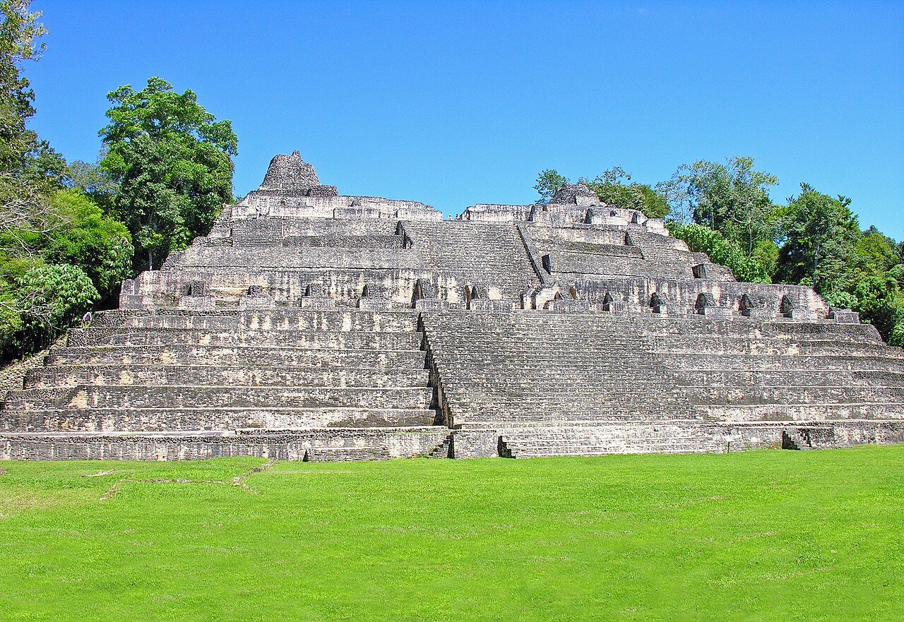
At Caracol in western Belize, flights conducted April 26–30, 2009 covered approximately 200 square kilometers. Arlen Chase and colleagues’ paper in the 2011 volume of the Journal of Archaeological Science showed how settlement, causeways and agricultural terraces formed a connected landscape. Caracol was already an extensively studied archaeological site: LiDAR expanded the map rather than discovering the city for the first time.
Guatemala: from individual sites to regional patterns
The PACUNAM survey acquired in 2016 covered 2,144 square kilometers of northern Guatemala. Marcello Canuto and colleagues published the results in Science on September 28, 2018. Their analysis identified 61,480 ancient structures across the surveyed areas, alongside evidence of extensive infrastructure and varied settlement density.
The study’s estimate of seven to eleven million people was an extrapolation to the broader central Maya lowlands during the Late Classic period, approximately AD 650–800—not a count of people inside the scanned footprint. The calculation depended on assumptions about settlement, occupation and regional representativeness. A mapped structure is not automatically one household, and structures visible together today were not necessarily all occupied simultaneously.
Mexico: Aguada Fénix and excavation-based dates
In Tabasco, Mexico, Takeshi Inomata and colleagues’ study published June 3, 2020 in Nature combined airborne LiDAR with excavations at Aguada Fénix. The researchers documented a vast artificial plateau about 1,400 meters long and 10–15 meters high, with nine radiating causeways.
They dated its construction to approximately 1000–800 BC using radiocarbon evidence and Bayesian analysis. Those dates came from archaeological sampling and chronological modeling, not from the laser measurements. The study illustrates the strongest partnership: remote mapping establishes large-scale form, while excavation supplies construction history and datable material. The authors interpreted the monument as evidence of substantial communal work, rather than treating its outline alone as proof of a particular political system.
What a mapped feature can—and cannot—tell us
Caracol’s researchers emphasized that ground checks and excavation add functional detail and dates to remotely mapped features. Apparent platforms, terraces or roads need testing against local terrain and archaeological context. LiDAR can guide that work, but a computer-generated label is not equivalent to an excavated building.
These studies were published in 2011, 2018 and 2020; they are milestones reviewed here, not new discoveries announced today. Together, they redirect attention from isolated monuments toward the spaces connecting homes, fields, water systems and public buildings. The achievement is a fuller framework for investigating Maya landscapes, with interpretation strengthened—not made unnecessary—by fieldwork.
Featured photograph: Caana at Caracol, Belize. Photograph by Dennis G. Jarvis / Wikimedia Commons, CC BY-SA 2.0. Resized; no editorial alterations. Site photograph, not a LiDAR image.