
By Seba | Khemetic.News | November 10, 2026
Long before modern pumping stations, Indigenous communities in what is now southern and central Arizona moved river water across dry land through extensive canal networks. Their achievement belongs at the center of any history of Ancient American Technology: a working landscape in which farming, construction and cooperation depended on understanding water.
Who built the networks?
The National Park Service distinguishes the ancestral Sonoran Desert people from “Hohokam,” an archaeological label rather than the name of a single living nation. Descendant communities retain connections to this heritage. Treating archaeological change as the disappearance of Indigenous people obscures those continuing relationships.
The canals formed part of a long agricultural history. NPS describes hundreds of miles of prehistoric channels across several Arizona river valleys. Corn, beans, squash, cotton and tobacco were among the crops supported by these farming traditions. Cultivation existed alongside gathering and hunting; desert knowledge involved more than irrigated fields alone.
Moving water meant designing a landscape
A canal works by connecting a water source to a destination at a lower elevation. Its route must account for the terrain: water needs sufficient fall to move, while an unsuitable channel can lose water, accumulate sediment or erode. This is the basic hydraulic problem that makes an irrigation network an engineering achievement rather than simply a collection of trenches.
At Casa Grande, the NPS account of Indigenous construction emphasizes that builders created and maintained extensive irrigation without metal tools. The distinction matters. An absence of metal machinery does not mean an absence of technical expertise. Planning routes, excavating channels and keeping them operational required skilled work and sustained attention.
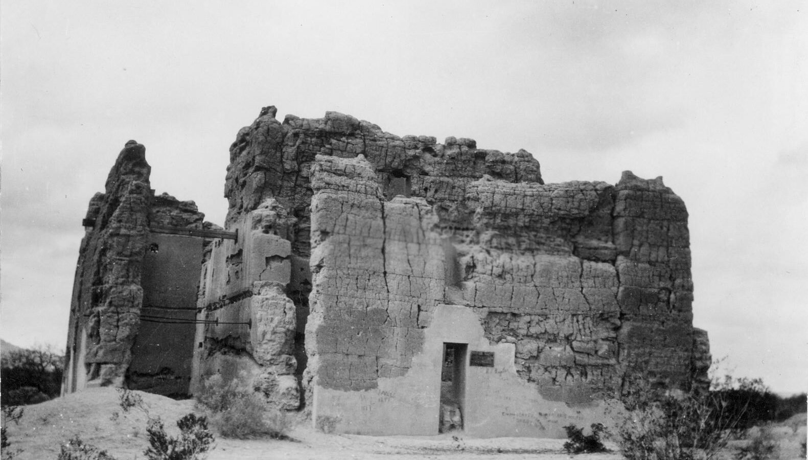
The surviving Great House also illustrates material knowledge. Its caliche construction used a naturally occurring mixture containing sand, clay and calcium carbonate. Water management and architecture therefore belonged to the same inhabited environment, although the precise functions of the Great House remain debated.
A canal was also a community commitment
The park’s Irrigation Communities interpretation describes villages connected along canal systems and working together to maintain water delivery. Compounds of households formed villages; major settlements could include plazas, platform mounds and ball courts. The network linked domestic life with larger gathering places.
That evidence makes maintenance central to the story. Digging a channel was only the beginning. A system had to remain usable across farming seasons, with communities depending on water arriving beyond the first settlement. Coordination was part of the technology itself, even when archaeology cannot recover every agreement or decision.
In an accompanying NPS interview, archaeologist Jerry Howard discusses the importance of major centers in controlling irrigation water. That interpretation helps explain why settlement location mattered. It does not establish that every canal community had identical leadership or that a single political model governed the entire region.
A useful Maya comparison
Maya communities also engineered water systems, but their solutions responded to different landscapes. At Tikal in Guatemala, a 2020 study of the Corriental reservoir identified zeolite and quartz deposits interpreted as evidence of filtration. Its emphasis is stored drinking water and water quality; the Arizona canal networks discussed here emphasize river diversion for agriculture.
The comparison reveals a shared technological question—how communities secure dependable water—without making the systems interchangeable. Similar ingenuity does not, by itself, establish direct contact or a common inventor. Each tradition deserves examination through its own archaeological evidence.
Reading the ruins without erasing living people
The NPS overview of Casa Grande recognizes continuing tribal connections to the site. The ruins are therefore more than an abandoned technical exhibit. They belong to a landscape with descendants, cultural responsibilities and enduring Indigenous knowledge.
Canal engineering expands what we recognize as ancient technology. Its most consequential structures were not always monumental buildings. Sometimes they were carefully maintained channels that carried water toward fields, supported households and bound neighboring communities together.
Featured photograph: Casa Grande in 1900, National Park Service, public domain. The photograph documents the Great House and surrounding ruins, not a surviving canal excavation.
Further reading: The linked National Park Service histories and interpretation above; Tankersley and colleagues, Scientific Reports (2020), “Zeolite water purification at Tikal, an ancient Maya city in Guatemala.” Continue our series with Maya pyramid construction at Tikal.